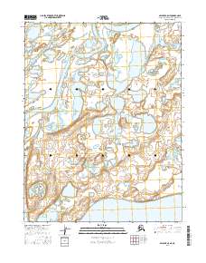
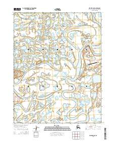
2016 Map of Selawik C-5 NE
USGS Topo · Published 2016About this map
Selawik Lake dominates the southern edge of this landscape in the Northwest Arctic, where the transition between open water and complex wetlands defines the terrain. The northern reaches are characterized by the meandering path of the Nazuruk Channel, which threads through a network of smaller ponds and seasonal waterways. This 2016 survey illustrates the intricate hydrography of the region just north of the Arctic Circle, reflecting the delicate balance of an environment where water and land are often indistinguishable. The map provides a precise look at the township and range divisions, such as t15n r12w and t16n r11w, which overlay this largely undeveloped expanse of the Alaskan interior.
Find a feature on this map
8 named features on this map. Tap any name to fly to it.
Don’t see what you’re looking for? This feature index may not catch every label — zoom into the map to look around manually.
Map Details
Editions of this 2016 Selawik C-5 NE Map
This is the sole edition of this map. No revisions or reprints were ever made.
Other maps of this area

1951 · Selawik
USGS Topo · 1:250,000

1955 · Selawik D-4
USGS Topo · 1:63,360

1955 · Selawik D-5
USGS Topo · 1:63,360

1955 · Selawik C-5
USGS Topo · 1:63,360

1955 · Selawik C-4
USGS Topo · 1:63,360

1957 · Selawik
USGS Topo · 1:250,000
2015 · Selawik D-4 SW
USGS Topo · 1:25,000
2015 · Selawik C-5 NW
USGS Topo · 1:25,000
2015 · Selawik D-5 SW
USGS Topo · 1:25,000
2015 · Selawik D-5 SE
USGS Topo · 1:25,000