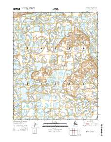
2015 Map of Selawik D-5 SW
USGS Topo · Published 2015About this map
Eavok Lake sits at the heart of this hydrologically complex landscape in the Selawik River delta region. The area is defined by a dense network of meandering waterways, including the prominent Melvin Channel to the west and the wandering Eavok Channel which weaves through the central wetlands. These channels facilitate movement through the water-logged tundra of the Northwest Arctic Borough, where the land and water are inextricably linked. To the south, the Riley Channel further illustrates the shifting, braided nature of these subarctic wetlands. The map provides a look at the precise township and range boundaries, such as t17n r13w, which overlay this seemingly fluid environment, documenting the formal land divisions in a region primarily shaped by seasonal water flow.
Find a feature on this map
8 named features on this map. Tap any name to fly to it.
Don’t see what you’re looking for? This feature index may not catch every label — zoom into the map to look around manually.
Map Details
Editions of this 2015 Selawik D-5 SW Map
This is the sole edition of this map. No revisions or reprints were ever made.
Other maps of this area

1951 · Selawik
USGS Topo · 1:250,000

1951 · Selawik C-6
USGS Topo · 1:63,360

1951 · Selawik D-6
USGS Topo · 1:63,360

1952 · Selawik D-6
USGS Topo · 1:63,360

1955 · Selawik D-5
USGS Topo · 1:63,360

1955 · Selawik C-5
USGS Topo · 1:63,360

1957 · Selawik
USGS Topo · 1:250,000
2015 · Selawik C-5 NW
USGS Topo · 1:25,000
2015 · Selawik D-5 SE
USGS Topo · 1:25,000
2015 · Selawik D-5 NE
USGS Topo · 1:25,000