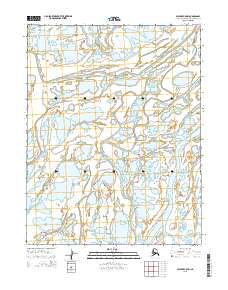
2015 Map of Selawik C-5 NW
USGS Topo · Published 2015About this map
Riley Channel and Olikatuk Channel wind through a complex wetland delta in the Northwest Arctic region of Alaska. This landscape is defined by the braided and intersecting waterways that serve as the primary geographical markers in an area devoid of roads or settlements. The drainage patterns shown here, including the Nazuruk Channel and Mukuksok Channel, represent a dynamic aquatic environment where the terrain is shaped by seasonal shifts and water movement. The map provides precise survey boundaries for several townships, such as t15n r13w and t16n r12w, which establish a grid over this remote wilderness. For researchers and historians of the Alaskan interior, these channels are the vital landmarks used for navigation and defining land use in a region where the water is the road.
Find a feature on this map
10 named features on this map. Tap any name to fly to it.
Don’t see what you’re looking for? This feature index may not catch every label — zoom into the map to look around manually.
Map Details
Editions of this 2015 Selawik C-5 NW Map
This is the sole edition of this map. No revisions or reprints were ever made.
Other maps of this area

1951 · Selawik
USGS Topo · 1:250,000

1951 · Selawik C-6
USGS Topo · 1:63,360

1951 · Selawik D-6
USGS Topo · 1:63,360

1952 · Selawik D-6
USGS Topo · 1:63,360

1955 · Selawik D-5
USGS Topo · 1:63,360

1955 · Selawik C-5
USGS Topo · 1:63,360

1957 · Selawik
USGS Topo · 1:250,000
2015 · Selawik D-5 SW
USGS Topo · 1:25,000
2015 · Selawik D-5 SE
USGS Topo · 1:25,000
2015 · Selawik D-6 SE
USGS Topo · 1:25,000