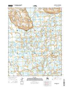
2015 Map of Selawik D-6 SE
USGS Topo · Published 2015About this map
Nulvororok Lake sits at the northern edge of this Arctic landscape, where the Ogriveg River winds through a vast network of wetlands and tundra. The geography is defined by a complex labyrinth of waterways, including the prominent Melvin Channel and Nulvororok Channel that cut through the low-lying terrain. These braided streams and sloughs suggest a dynamic hydrosystem typical of the region's delta-like environments. To the south, the Riley Channel and Eavok Channel continue the pattern of intricate drainage, providing a clear look at the natural aquatic corridors that dictate travel and subsistence patterns in the Northwest Arctic Borough. The lack of man-made infrastructure on the sheet emphasizes the undisturbed character of this remote Alaskan wilderness during the early twenty-first century.
Find a feature on this map
10 named features on this map. Tap any name to fly to it.
Don’t see what you’re looking for? This feature index may not catch every label — zoom into the map to look around manually.
Map Details
Editions of this 2015 Selawik D-6 SE Map
This is the sole edition of this map. No revisions or reprints were ever made.
Other maps of this area

1951 · Selawik
USGS Topo · 1:250,000

1951 · Selawik C-6
USGS Topo · 1:63,360

1951 · Selawik D-6
USGS Topo · 1:63,360

1952 · Selawik D-6
USGS Topo · 1:63,360

1955 · Selawik D-5
USGS Topo · 1:63,360

1955 · Selawik C-5
USGS Topo · 1:63,360

1957 · Selawik
USGS Topo · 1:250,000
2014 · Selawik D-6 NW
USGS Topo · 1:25,000
2014 · Selawik D-6 SW
USGS Topo · 1:25,000
2015 · Selawik C-5 NW
USGS Topo · 1:25,000