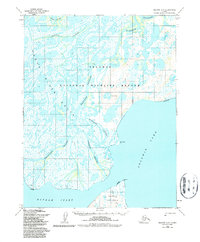
1955 Map of Selawik C-5
USGS Topo · Published 1987About this map
The Kobuk River Delta dominates this mid-century topographic record, revealing a complex web of waterways that define the northern entrance to Selawik Lake. Within the Selawik National Wildlife Refuge, the landscape is partitioned by a network of significant channels including Riley Channel, Nazuruk Channel, and Attiunik Channel. These braids suggest a dynamic environment where the river meets the tide, shaping the geography of the Hotham Inlet and the southern reaches of the Baldwin Peninsula.
Find a feature on this map
18 named features on this map. Tap any name to fly to it.
Don’t see what you’re looking for? This feature index may not catch every label — zoom into the map to look around manually.
Map Details
Editions of this 1955 Selawik C-5 Map
2 editions found
Other maps of this area

1951 · Selawik
USGS Topo · 1:250,000

1951 · Selawik C-6
USGS Topo · 1:63,360

1951 · Selawik B-6
USGS Topo · 1:63,360

1951 · Selawik D-6
USGS Topo · 1:63,360

1951 · Selawik B-5
USGS Topo · 1:63,360

1952 · Selawik D-6
USGS Topo · 1:63,360

1955 · Selawik D-4
USGS Topo · 1:63,360

1955 · Selawik D-5
USGS Topo · 1:63,360

1955 · Selawik B-4
USGS Topo · 1:63,360

1955 · Selawik C-5
USGS Topo · 1:63,360