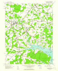
1943 Map of Selbyville
USGS Topo · Published 1962About this map
The Pennsylvania railroad corridor anchors this mid-century survey of the Delmarva borderlands, passing through Selbyville as it heads toward the Maryland line. The landscape is defined by the intricate tidal reaches of the St Martin River, where features like Shingle Landing Prong and Bishopville Prong carve into the low-lying coastal plain. Rural life is centered around scattered settlements such as Bishopville, Roxana, and Showell, with local institutions like St Martins Ch and District No 6 school serving the agrarian community. The map reveals a complex network of drainage ditches and branches, such as Buntings Line Ditch, illustrating the intensive efforts to manage the wetlands for agriculture during the early 1940s. Points of land such as Peach Point and Saltgrass Point provide a clear view of the estuary's shoreline before modern coastal development.
Find a feature on this map
59 named features on this map. Tap any name to fly to it.
Don’t see what you’re looking for? This feature index may not catch every label — zoom into the map to look around manually.
Map Details
Editions of this 1943 Selbyville Map
2 editions found

Other maps of this area

1901 · Ocean City
USGS Topo · 1:62,500

1902 · Pittsville
USGS Topo · 1:62,500

1917 · Millsboro
USGS Topo · 1:62,500

1918 · Rehoboth
USGS Topo · 1:62,500

1938 · Millsboro
USGS Topo · 1:62,500

1938 · Rehoboth
USGS Topo · 1:62,500

1942 · Ocean City
USGS Topo · 1:62,500

1942 · Ninepin
USGS Topo · 1:24,000

1942 · Ocean City
USGS Topo · 1:24,000

1942 · Whaleysville
USGS Topo · 1:24,000