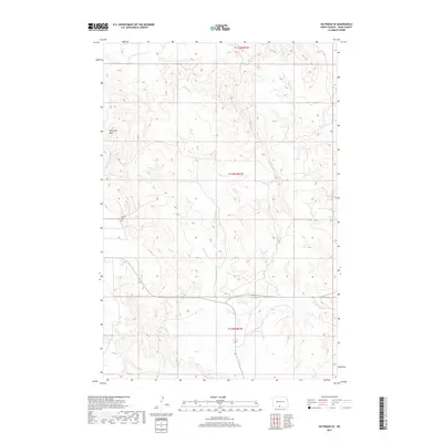
2017 Map of Selfridge SE
USGS Topo · Published 2017About this map
Porcupine Hills dominate the western landscape of this North Dakota terrain, where the topography of the Fort Yates District is defined by sharp elevation shifts and winding watercourses. This 2017 survey documents the rural character of Sioux County, where human presence is sparse but deeply rooted in specific landmarks. The Gayton Cem stands as a significant historical site, offering a point of connection for genealogists researching families from this portion of the Standing Rock Reservation area. Water management and natural drainage are evident through the paths of Fourmile Cr and Onemile Cr, which cut through the high ground. The map details the Township and Range system across t131n r81w, t130n r81w, and t129n r81w, providing a clear structural framework for land ownership and historical land use studies.
Find a feature on this map
7 named features on this map. Tap any name to fly to it.
Don’t see what you’re looking for? This feature index may not catch every label — zoom into the map to look around manually.
Map Details
Editions of this 2017 Selfridge SE Map
This is the sole edition of this map. No revisions or reprints were ever made.
Other maps of this area

1953 · McIntosh
USGS Topo · 1:250,000

1954 · Bismarck
USGS Topo · 1:250,000

1958 · Bismarck
USGS Topo · 1:250,000

1958 · McIntosh
USGS Topo · 1:250,000

1966 · McLaughlin NE
USGS Topo · 1:24,000

1966 · Mahto NW
USGS Topo · 1:24,000

1968 · Fort Yates NW
USGS Topo · 1:24,000

1968 · Fort Yates
USGS Topo · 1:24,000

1971 · Barren Butte
USGS Topo · 1:24,000

1971 · Froelich Dam
USGS Topo · 1:24,000