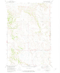
1971 Map of Selfridge SE
USGS Topo · Published 1974About this map
The Porcupine Hills dominate the western horizon of this Sioux County landscape, which was documented during the early 1970s as part of a federal development program for the Missouri River Basin. The terrain is defined by a complex network of drainages and high ridges, where the seasonal flow of Fourmile Creek cuts through the prairie toward the Missouri River. A small, isolated cemetery known as Gayton Cem is the primary evidence of human settlement on this portion of the Standing Rock Indian Reservation, offering a specific point of interest for genealogists researching early regional burials. The map's sparse labels reflect a vast, open rangeland where section lines and unimproved trails provide the only grid for navigation across the dissected topography.
Find a feature on this map
3 named features on this map. Tap any name to fly to it.
Don’t see what you’re looking for? This feature index may not catch every label — zoom into the map to look around manually.
Map Details
Editions of this 1971 Selfridge SE Map
This is the sole edition of this map. No revisions or reprints were ever made.
Other maps of this area

1953 · McIntosh
USGS Topo · 1:250,000

1954 · Bismarck
USGS Topo · 1:250,000

1958 · Bismarck
USGS Topo · 1:250,000

1958 · McIntosh
USGS Topo · 1:250,000

1966 · McLaughlin NE
USGS Topo · 1:24,000

1966 · Mahto NW
USGS Topo · 1:24,000

1968 · Fort Yates NW
USGS Topo · 1:24,000

1968 · Fort Yates
USGS Topo · 1:24,000

1971 · Barren Butte
USGS Topo · 1:24,000

1971 · Froelich Dam
USGS Topo · 1:24,000