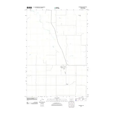
2011 Map of Selfridge
USGS Topo · Published 2011About this map
Selfridge serves as the primary settlement in this portion of Sioux County, organized around a traditional grid with streets like Main St and 1st St defining the town center. The landscape is dominated by the meandering path of Porcupine Creek, which snakes across the plains toward the elevated Porcupine Hills in the northeast. This 2011 survey captures the area's rural character, where large sections of open land are divided by a rectilinear road network including 95th St and 25th Ave. A significant genealogical landmark, the Saint Philomena Cemetery, sits south of the main town site along 97th St, providing a localized point of interest for those researching the region's history and residents.
Find a feature on this map
15 named features on this map. Tap any name to fly to it.
Don’t see what you’re looking for? This feature index may not catch every label — zoom into the map to look around manually.
Map Details
Editions of this 2011 Selfridge Map
This is the sole edition of this map. No revisions or reprints were ever made.
Other maps of this area

1953 · McIntosh
USGS Topo · 1:250,000

1954 · Bismarck
USGS Topo · 1:250,000

1958 · Bismarck
USGS Topo · 1:250,000

1958 · McIntosh
USGS Topo · 1:250,000

1966 · McLaughlin NE
USGS Topo · 1:24,000

1971 · Barren Butte
USGS Topo · 1:24,000

1971 · Froelich Dam
USGS Topo · 1:24,000

1971 · Porcupine
USGS Topo · 1:24,000
1971 · Selfridge SE
USGS Topo · 1:24,000

1971 · Selfridge
USGS Topo · 1:24,000
Featured Places
- Fort Yates District, ND
- Selfridge, Porcupine District
- Porcupine District, ND
- Sioux County, ND
- United States