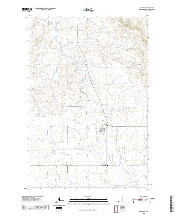
2024 Map of Selfridge
USGS Topo · Published 2024About this map
Selfridge occupies the center of this Sioux County landscape, where the street grid of Main St, 1st St, and 2nd Ave N defines the town’s small urban footprint. The surrounding terrain is shaped by the winding course of Porcupine Creek, which cuts through the southern and western portions of the quadrangle, and the rising elevations of the Porcupine Hills in the northeast corner. This map provides critical details for local history and genealogical research, specifically identifying the locations of Saint Philomena Cem at the edge of the townsite and the Old Saint Philomena Cem further south. The rural landscape is organized by a systematic road network, including Section Line Rd and numerically named routes like 95th St, which reflect the prairie’s enduring section-and-township structure.
Find a feature on this map
24 named features on this map. Tap any name to fly to it.
Don’t see what you’re looking for? This feature index may not catch every label — zoom into the map to look around manually.
Map Details
Editions of this 2024 Selfridge Map
This is the sole edition of this map. No revisions or reprints were ever made.
Other maps of this area

1953 · McIntosh
USGS Topo · 1:250,000

1954 · Bismarck
USGS Topo · 1:250,000

1958 · Bismarck
USGS Topo · 1:250,000

1958 · McIntosh
USGS Topo · 1:250,000

1966 · McLaughlin NE
USGS Topo · 1:24,000

1971 · Barren Butte
USGS Topo · 1:24,000

1971 · Froelich Dam
USGS Topo · 1:24,000

1971 · Porcupine
USGS Topo · 1:24,000
1971 · Selfridge SE
USGS Topo · 1:24,000

1971 · Selfridge
USGS Topo · 1:24,000
Featured Places
- Fort Yates District, ND
- Selfridge, Porcupine District
- Porcupine District, ND
- Sioux County, ND
- United States