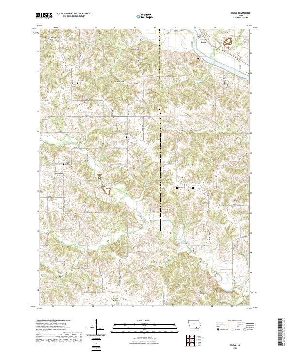
2022 Map of Selma
USGS Topo · Published 2022About this map
The Des Moines River cuts through the northeast corner of this Iowa landscape, where the village of Selma sits near the crossing of Bridge St and the river's edge. This 2022 survey details a region defined by its small, scattered settlements and a dense network of family and community burying grounds. Places like White Elm and Troy anchor the southern and central sections, connected by a grid of rural roads such as Wind Ave and Bethel Rock Rd that weave through the drainage basins of Chequest Creek and S Chequest Cr. The high density of named cemeteries, including Bethlehem Cem, Glasgow Cem, and Mount Gilead Cem, provides a clear map of local genealogy and historic parish centers that have persisted even as the broader agricultural landscape has shifted over time.
Find a feature on this map
83 named features on this map. Tap any name to fly to it.
Don’t see what you’re looking for? This feature index may not catch every label — zoom into the map to look around manually.
Map Details
Editions of this 2022 Selma Map
This is the sole edition of this map. No revisions or reprints were ever made.
Other maps of this area

1954 · Centerville
USGS Topo · 1:250,000

1956 · Agency
USGS Topo · 1:24,000

1956 · Ottumwa South
USGS Topo · 1:62,500

1957 · Centerville
USGS Topo · 1:250,000

1958 · Centerville
USGS Topo · 1:250,000
1965 · Eldon
USGS Topo · 1:24,000

1965 · Selma
USGS Topo · 1:24,000
1965 · Libertyville
USGS Topo · 1:24,000

1965 · Douds
USGS Topo · 1:24,000
1970 · Cantril
USGS Topo · 1:24,000