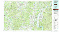
1986 Map of Selmer
USGS Topo · Published 1993About this map
Shiloh National Military Park stands as a primary landmark along the Tennessee River in this 1980s-era study, documenting the landscape of West Tennessee and the Alabama borderlands. The geography is defined by the sweeping bends of the river, including Hookers Bend and Pitts Bend, as it flows north from the Pickwick Landing Dam. This period shows a region well-connected by the Illinois Central Gulf RR and major corridors like U.S. 64, while preserving significant natural and recreational areas such as Chickasaw State Forest and Park and Big Hill Pond State Park.
Find a feature on this map
107 named features on this map. Tap any name to fly to it.
Don’t see what you’re looking for? This feature index may not catch every label — zoom into the map to look around manually.
Map Details
Editions of this 1986 Selmer Map
3 editions found
Other maps of this area

1905 · Waynesboro
USGS Topo · 1:125,000

1911 · Iuka
USGS Topo · 1:48,000

1914 · Iuka
USGS Topo · 1:62,500

1924 · Gravelly Springs
USGS Topo · 1:48,000

1926 · Gravelly Springs
USGS Topo · 1:62,500

1935 · Doskie
USGS Topo · 1:24,000

1935 · Wright
USGS Topo · 1:24,000

1936 · Savannah
USGS Topo · 1:24,000

1936 · Wolf Pit Ridge
USGS Topo · 1:24,000

1936 · Waterloo
USGS Topo · 1:24,000