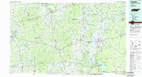
1986 Map of Selmer
USGS Topo · Published 1986About this map
The Tennessee River serves as a central artery for West Tennessee in this 1980s-era study, flowing past the site of Shiloh National Military Park and through the engineered waters of Pickwick Lake. The landscape is a mix of protected timberlands and ancient history, featuring Chickasaw State Forest and Park alongside the Pinson Mounds State Archaeological Area. In the river-bend country of Hardin Co, the Pickwick Landing Dam stands as a significant industrial landmark, while inland, the rail-oriented growth of Selmer and Henderson reflects the region's transport evolution.
Find a feature on this map
130 named features on this map. Tap any name to fly to it.
Don’t see what you’re looking for? This feature index may not catch every label — zoom into the map to look around manually.
Map Details
Editions of this 1986 Selmer Map
3 editions found
Other maps of this area

1905 · Waynesboro
USGS Topo · 1:125,000

1911 · Iuka
USGS Topo · 1:48,000

1914 · Iuka
USGS Topo · 1:62,500

1924 · Gravelly Springs
USGS Topo · 1:48,000

1926 · Gravelly Springs
USGS Topo · 1:62,500

1935 · Doskie
USGS Topo · 1:24,000

1935 · Wright
USGS Topo · 1:24,000

1936 · Savannah
USGS Topo · 1:24,000

1936 · Wolf Pit Ridge
USGS Topo · 1:24,000

1936 · Waterloo
USGS Topo · 1:24,000