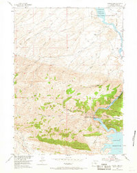
1953 Map of Seminoe Dam
USGS Topo · Published 1968About this map
Seminoe Dam and the nearby Kortes Dam anchor this mid-century topographic study of the North Platte River canyon. The landscape is defined by the massive impoundments of the Seminoe Reservoir and Kortes Reservoir, which occupy the deep gorges of Black Canyon. Mapping completed in 1953 reveals the infrastructure of the Missouri River Basin development program during its peak expansion, showing the spillways and gaging stations essential to water management in Carbon County.
Find a feature on this map
30 named features on this map. Tap any name to fly to it.
Don’t see what you’re looking for? This feature index may not catch every label — zoom into the map to look around manually.
Map Details
Editions of this 1953 Seminoe Dam Map
4 editions found
Other maps of this area

1953 · Leo
USGS Topo · 1:24,000

1953 · Bradley Peak
USGS Topo · 1:24,000

1953 · Seminoe Dam NE
USGS Topo · 1:24,000

1953 · Seminoe Dam
USGS Topo · 1:24,000

1953 · Wild Horse Mountain
USGS Topo · 1:24,000

1953 · Seminoe Dam SW
USGS Topo · 1:24,000

1953 · Pathfinder Reservoir SW
USGS Topo · 1:24,000

1953 · Buzzard Ranch
USGS Topo · 1:24,000

1953 · Seminoe Dam SE
USGS Topo · 1:24,000

1955 · Casper
USGS Topo · 1:250,000