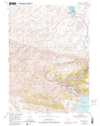
1953 Map of Seminoe Dam
USGS Topo · Published 1983About this map
The North Platte River carves a dramatic path through the Seminoe Mountains, serving as the centerpiece for major mid-century hydroelectric and irrigation infrastructure. The landscape is defined by the three-stage reservoir system, including the massive Seminoe Reservoir and the more compact Kortes Reservoir tucked within Seminoe Canyon. This 1953 field-checked survey highlights the early decades of the Seminoe Dam and Kortes Dam operations, which transformed the rugged high-desert hydrology of Carbon County.
Find a feature on this map
31 named features on this map. Tap any name to fly to it.
Don’t see what you’re looking for? This feature index may not catch every label — zoom into the map to look around manually.
Map Details
Editions of this 1953 Seminoe Dam Map
4 editions found
Other maps of this area

1953 · Leo
USGS Topo · 1:24,000

1953 · Bradley Peak
USGS Topo · 1:24,000

1953 · Seminoe Dam NE
USGS Topo · 1:24,000

1953 · Seminoe Dam
USGS Topo · 1:24,000

1953 · Wild Horse Mountain
USGS Topo · 1:24,000

1953 · Seminoe Dam SW
USGS Topo · 1:24,000

1953 · Pathfinder Reservoir SW
USGS Topo · 1:24,000

1953 · Buzzard Ranch
USGS Topo · 1:24,000

1953 · Seminoe Dam SE
USGS Topo · 1:24,000

1955 · Casper
USGS Topo · 1:250,000