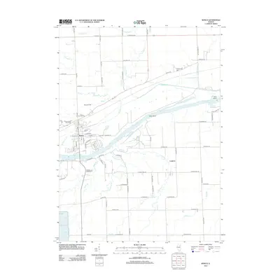
2012 Map of Seneca
USGS Topo · Published 2012About this map
The Illinois River cuts through the heart of this landscape, framing the industrial and navigational character of Seneca. This river corridor is defined by features such as Barry Island and Grist Island, while the northern bank supports the residential and commercial layout of the town. Local genealogy and history are anchored by Mount Calvary Catholic Cem and Mount Hope Cem, situated on the western edge near Rat Run. The terrain shifts from the river bottomlands to higher ground at Holderman Hill, illustrating the varied topography of Grundy County.
Find a feature on this map
79 named features on this map. Tap any name to fly to it.
Don’t see what you’re looking for? This feature index may not catch every label — zoom into the map to look around manually.
Map Details
Editions of this 2012 Seneca Map
This is the sole edition of this map. No revisions or reprints were ever made.
Other maps of this area

1892 · Morris
USGS Topo · 1:62,500

1892 · Marseilles
USGS Topo · 1:62,500

1916 · Marseilles
USGS Topo · 1:62,500

1918 · Morris
USGS Topo · 1:62,500

1940 · Marseilles
USGS Topo · 1:62,500

1948 · Dwight
USGS Topo · 1:62,500

1950 · Dwight
USGS Topo · 1:62,500

1953 · Morris
USGS Topo · 1:24,000

1953 · Lisbon
USGS Topo · 1:24,000
1954 · Morris
USGS Topo · 1:62,500