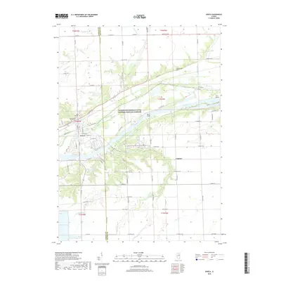
2018 Map of Seneca
USGS Topo · Published 2018About this map
The Illinois River cuts a wide path through this portion of the Illinois and Michigan Canal National Heritage Corridor, where the village of Seneca sits at the intersection of river trade and inland travel. This 2018 survey reveals the landscape of the LaSalle and Grundy county line, defined by the winding courses of Nettle Creek, Rat Run, and Hog Run. To the north, Holderman Hill rises above the alluvial plains, while islands like Barry Island and Grist Island break the river's flow.
Find a feature on this map
57 named features on this map. Tap any name to fly to it.
Don’t see what you’re looking for? This feature index may not catch every label — zoom into the map to look around manually.
Map Details
Editions of this 2018 Seneca Map
This is the sole edition of this map. No revisions or reprints were ever made.
Other maps of this area

1892 · Morris
USGS Topo · 1:62,500

1892 · Marseilles
USGS Topo · 1:62,500

1916 · Marseilles
USGS Topo · 1:62,500

1918 · Morris
USGS Topo · 1:62,500

1940 · Marseilles
USGS Topo · 1:62,500

1948 · Dwight
USGS Topo · 1:62,500

1950 · Dwight
USGS Topo · 1:62,500

1953 · Morris
USGS Topo · 1:24,000

1953 · Lisbon
USGS Topo · 1:24,000
1954 · Morris
USGS Topo · 1:62,500