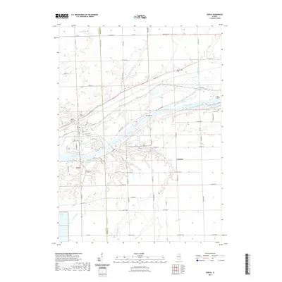
2021 Map of Seneca
USGS Topo · Published 2021About this map
The Seneca village center and the Illinois River corridor dominate this 2021 landscape at the border of LaSalle and Grundy counties. The map details the intricate relationship between the river, the CSX railroad, and the historic I & M Canal Rd route, illustrating how transportation remains the backbone of the region's layout. Settlement patterns are focused around the river bluffs, where Mount Calvary Cem and Mount Hope Cem are situated overlooking the valley.
Find a feature on this map
78 named features on this map. Tap any name to fly to it.
Don’t see what you’re looking for? This feature index may not catch every label — zoom into the map to look around manually.
Map Details
Editions of this 2021 Seneca Map
This is the sole edition of this map. No revisions or reprints were ever made.
Other maps of this area

1892 · Morris
USGS Topo · 1:62,500

1892 · Marseilles
USGS Topo · 1:62,500

1916 · Marseilles
USGS Topo · 1:62,500

1918 · Morris
USGS Topo · 1:62,500

1940 · Marseilles
USGS Topo · 1:62,500

1948 · Dwight
USGS Topo · 1:62,500

1950 · Dwight
USGS Topo · 1:62,500

1953 · Morris
USGS Topo · 1:24,000

1953 · Lisbon
USGS Topo · 1:24,000
1954 · Morris
USGS Topo · 1:62,500