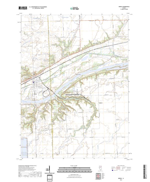
2024 Map of Seneca
USGS Topo · Published 2024About this map
The Illinois River corridor defines the landscape of this LaSalle and Grundy County border region, where modern infrastructure meets 19th-century transport routes. At the center of the sheet, Seneca sits at the intersection of river traffic and the historic I & M Canal, a legacy of the era's waterway expansion. The terrain is marked by significant hydrological features, from the large LaSalle County Nuclear Station Cooling Pond in the southwest corner to the network of smaller runs like Deadly Run and Hog Run that drain into the river valley. To the east, the settlement of Langham and prominent elevations like Holderman Hill overlook the floodplain. The map captures the continued importance of the river islands, including Barry Island and Grist Island, alongside local landmarks like Mount Calvary Cem, providing a detailed view of the area's contemporary development and preserved open spaces.
Find a feature on this map
52 named features on this map. Tap any name to fly to it.
Don’t see what you’re looking for? This feature index may not catch every label — zoom into the map to look around manually.
Map Details
Editions of this 2024 Seneca Map
This is the sole edition of this map. No revisions or reprints were ever made.
Other maps of this area

1892 · Morris
USGS Topo · 1:62,500

1892 · Marseilles
USGS Topo · 1:62,500

1916 · Marseilles
USGS Topo · 1:62,500

1918 · Morris
USGS Topo · 1:62,500

1940 · Marseilles
USGS Topo · 1:62,500

1948 · Dwight
USGS Topo · 1:62,500

1950 · Dwight
USGS Topo · 1:62,500

1953 · Morris
USGS Topo · 1:24,000

1953 · Lisbon
USGS Topo · 1:24,000
1954 · Morris
USGS Topo · 1:62,500