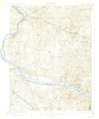
1908 Map of Seneca
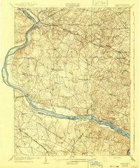
USGS Topo · Published 1945About this map
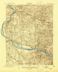
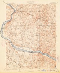
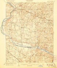
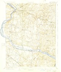
The Potomac River corridor at the turn of the century serves as a vital transportation artery, defined by the parallel paths of the Chesapeake and Ohio Canal and the Baltimore and Ohio Railroad. This survey, conducted in 1907, captures the agricultural heart of Montgomery County before its suburban expansion, featuring established crossroads like Poolesville and Germantown. River crossings remain essential to local commerce and travel, evidenced by the active Whites Ferry and Edwards Ferry.
Find a feature on this map
66 named features on this map. Tap any name to fly to it.
Don’t see what you’re looking for? This feature index may not catch every label — zoom into the map to look around manually.
Map Details
Editions of this 1908 Seneca Map
7 editions found

Other maps of this area

1884 · Harpers Ferry
USGS Topo · 1:125,000

1890 · Mt. Vernon
USGS Topo · 1:125,000

1891 · Harpers Ferry
USGS Topo · 1:125,000

1891 · Mt. Vernon
USGS Topo · 1:125,000

1893 · Frederick
USGS Topo · 1:125,000

1893 · Harpers Ferry
USGS Topo · 1:125,000

1894 · Warrenton
USGS Topo · 1:125,000

1894 · Frederick
USGS Topo · 1:125,000

1894 · Mt. Vernon
USGS Topo · 1:125,000

1897 · Mt. Vernon
USGS Topo · 1:125,000