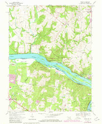
1968 Map of Seneca
USGS Topo · Published 1980About this map
Potomac River islands and historical canal infrastructure dominate this landscape at the intersection of Maryland and Virginia. The map details the Chesapeake and Ohio Canal Towpath winding along the northern bank, passing through the Seneca Creek State Park and past the small settlement of Seneca. On the Virginia side, the topography rises away from the river into the wooded hills of Fairfax and Loudoun counties, where the crossroads at Dranesville and its associated Dranesville Tavern Park reflect the area's history as a transit corridor.
Find a feature on this map
69 named features on this map. Tap any name to fly to it.
Don’t see what you’re looking for? This feature index may not catch every label — zoom into the map to look around manually.
Map Details
Editions of this 1968 Seneca Map
4 editions found

Other maps of this area

1890 · Mt. Vernon
USGS Topo · 1:125,000

1891 · Mt. Vernon
USGS Topo · 1:125,000

1893 · Frederick
USGS Topo · 1:125,000

1894 · Frederick
USGS Topo · 1:125,000

1894 · Mt. Vernon
USGS Topo · 1:125,000

1897 · Mt. Vernon
USGS Topo · 1:125,000

1900 · Washington
USGS Topo · 1:62,500

1908 · Rockville
USGS Topo · 1:62,500

1908 · Seneca
USGS Topo · 1:62,500

1915 · Fairfax
USGS Topo · 1:62,500