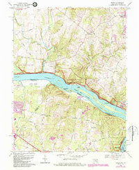
1968 Map of Seneca
USGS Topo · Published 1984About this map
The Potomac River carves a dramatic boundary through this 1960s survey, separating Montgomery County, Maryland, from the Virginia counties of Loudoun and Fairfax. This corridor is defined by the Chesapeake and Ohio Canal National Historical Park, where historical locks like Lock 24 and Lock 23 near Rushville trace the legacy of nineteenth-century river commerce. Further downstream, the river fragments into a series of significant landforms, including Watkins Island, Clagett Island, and Conn Island, leading toward the complex hydrology of Great Falls National Park.
Find a feature on this map
71 named features on this map. Tap any name to fly to it.
Don’t see what you’re looking for? This feature index may not catch every label — zoom into the map to look around manually.
Map Details
Editions of this 1968 Seneca Map
4 editions found

Other maps of this area

1890 · Mt. Vernon
USGS Topo · 1:125,000

1891 · Mt. Vernon
USGS Topo · 1:125,000

1893 · Frederick
USGS Topo · 1:125,000

1894 · Frederick
USGS Topo · 1:125,000

1894 · Mt. Vernon
USGS Topo · 1:125,000

1897 · Mt. Vernon
USGS Topo · 1:125,000

1900 · Washington
USGS Topo · 1:62,500

1908 · Rockville
USGS Topo · 1:62,500

1908 · Seneca
USGS Topo · 1:62,500

1915 · Fairfax
USGS Topo · 1:62,500