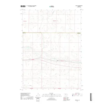
2017 Map of Seneca SW
USGS Topo · Published 2017About this map
The Middle Loup River winds eastward through the heart of this landscape, carving a distinct valley amidst the high, undulating terrain of the Nebraska Sandhills. Situated primarily within Hooker Co, this area is defined by its sparse settlement and vast, open spaces where the river provides the primary geographical anchor for the small community of Kelso. The transportation network is minimal, consisting of rural routes such as Fourmile Rd to the north and Heritage Rd to the south, reflecting the agrarian and ranching character of the region. The boundary between Cherry Co and Hooker Co runs across the upper third of the sheet, marking a significant political division in a territory where natural landforms dominate. This map captures the intersection of the river's riparian corridor with the surrounding dunes, highlighting the essential role of water in the development of the Nebraska interior.
Find a feature on this map
12 named features on this map. Tap any name to fly to it.
Don’t see what you’re looking for? This feature index may not catch every label — zoom into the map to look around manually.
Map Details
Editions of this 2017 Seneca SW Map
This is the sole edition of this map. No revisions or reprints were ever made.
Other maps of this area

1947 · Dismal River Ranch
USGS Topo · 1:62,500

1948 · Seneca
USGS Topo · 1:62,500

1948 · Mullen
USGS Topo · 1:62,500

1949 · Dismal River Ranch
USGS Topo · 1:62,500

1950 · Shimmins Lake
USGS Topo · 1:62,500

1951 · Mullen
USGS Topo · 1:62,500

1951 · Seneca
USGS Topo · 1:62,500

1954 · North Platte
USGS Topo · 1:250,000

1956 · North Platte
USGS Topo · 1:250,000

1957 · North Platte
USGS Topo · 1:250,000