2024 Map of Serena
USGS Topo · Published 2024About this map
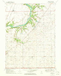
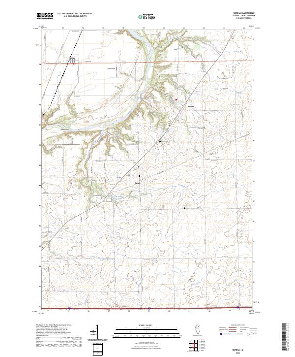
The Fox River carves a winding path through this LaSalle County landscape, creating a dramatic corridor of bluffs and small islands such as Indian Island. This modern survey illustrates the enduring rural character of the region, where historic hamlets like Serena, Norway, and Danway remain central to the local geography. The map is particularly notable for its dense concentration of family and community burial grounds, including the Osmundson Cem, David Strawn Cem, and Nelson Cem, which offer significant value for genealogical research and local history tracing.
Find a feature on this map
53 named features on this map. Tap any name to fly to it.
Don’t see what you’re looking for? This feature index may not catch every label — zoom into the map to look around manually.
Map Details
Editions of this 2024 Serena Map
This is the sole edition of this map. No revisions or reprints were ever made.