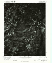
1977 Map of Seven Springs
USGS Topo · Published 1979About this map
Seven Springs sits as the focal point of this 1970s orthophotoquad, showing the mountain resort area's footprint in Somerset County. The map provides a rare visual of the land’s transition from wooded slopes to the cleared development at the resort itself, contrasting the dense forest cover of the Laurel Highlands with the organized layout of trails and facilities. To the west, the settlements of Champion and Maple Grove anchor the local road network, while the drainage of Jones Mill Run carves through the central terrain. Unlike traditional topographic maps, this aerial imagery reveals the actual density of timber and the specific configuration of mountain properties during a period of significant regional growth.
Find a feature on this map
4 named features on this map. Tap any name to fly to it.
Don’t see what you’re looking for? This feature index may not catch every label — zoom into the map to look around manually.
Map Details
Editions of this 1977 Seven Springs Map
This is the sole edition of this map. No revisions or reprints were ever made.
Other maps of this area

1913 · Somerset
USGS Topo · 1:62,500

1915 · Somerset
USGS Topo · 1:62,500

1921 · Meyersdale
USGS Topo · 1:62,500

1922 · Confluence
USGS Topo · 1:62,500

1922 · Donegal
USGS Topo · 1:62,500

1931 · Confluence
USGS Topo · 1:62,500

1933 · Confluence
USGS Topo · 1:62,500

1935 · Donegal
USGS Topo · 1:62,500

1939 · Meyersdale
USGS Topo · 1:62,500

1944 · Somerset
USGS Topo · 1:62,500
Featured Places
- Seven Springs, PA
- Springfield Township, PA
- Saltlick Township, PA
- Kregar, Donegal Township
- Maple Grove, Saltlick Township