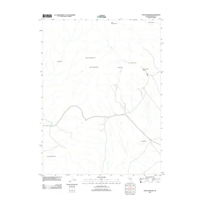
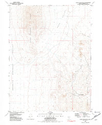
2011 Map of Seven Troughs
USGS Topo · Published 2011About this map
Seven Troughs (Historical) and the Mazuma Post Office represent the enduring legacy of early 20th-century mining efforts in this high desert landscape. Located within the Seven Troughs Range, these sites mark the remnants of a short-lived but intense mining boom where water sources like Willow Spring and Porter Spring were critical for survival. The topography is dominated by the peaks of the range, including Seven Troughs Mountain and Signal Peak, which overlook the expansive Granite Springs Valley and Sage Valley. The drainages of Seven Troughs Canyon and Burnt Canyon further define the rugged corridor where prospectors once sought gold and silver, leaving behind these historical markers in the Pershing County wilderness.
Find a feature on this map
15 named features on this map. Tap any name to fly to it.
Don’t see what you’re looking for? This feature index may not catch every label — zoom into the map to look around manually.
Map Details
Editions of this 2011 Seven Troughs Map
This is the sole edition of this map. No revisions or reprints were ever made.
Other maps of this area

1931 · Lovelock
USGS Topo · 1:250,000

1935 · Lovelock
USGS Topo · 1:250,000

1955 · Lovelock
USGS Topo · 1:250,000

1959 · Lovelock
USGS Topo · 1:250,000

1981 · Bluewing Flat North
USGS Topo · 1:24,000
1981 · Dead Horse Canyon
USGS Topo · 1:24,000
1981 · Seven Troughs
USGS Topo · 1:24,000

1981 · Trinity Pass
USGS Topo · 1:24,000
1981 · Trinity Pass NW
USGS Topo · 1:24,000
1981 · Seven Troughs SE
USGS Topo · 1:24,000