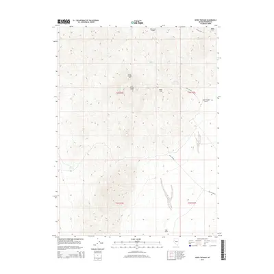
2015 Map of Seven Troughs
USGS Topo · Published 2015About this map
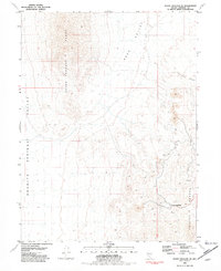
The Seven Troughs Range dominates this Pershing County landscape, with its high point at Seven Troughs Mtn rising above the surrounding arid basins. The topography is defined by sharp elevation changes, particularly around Signal Peak and the descent into Seven Troughs Canyon. These landforms suggest a history of prospecting and ranching common to the high desert of Nevada, where water access was the primary driver of human activity. Sparse but critical water sources like Willow Spring and Porter Spring are the only named hydrological features in this otherwise dry environment. Transportation across the territory is anchored by the Seven Troughs Rd, which skirts the southern edges of the range. To the south, the terrain levels out into the broad expanse of Sage Valley, providing a stark contrast to the steep canyons like Wild Horse Canyon and Burnt Canyon found in the northern reaches of the quadrangle.
Find a feature on this map
14 named features on this map. Tap any name to fly to it.
Don’t see what you’re looking for? This feature index may not catch every label — zoom into the map to look around manually.
Map Details
Editions of this 2015 Seven Troughs Map
This is the sole edition of this map. No revisions or reprints were ever made.
Other maps of this area

1931 · Lovelock
USGS Topo · 1:250,000

1935 · Lovelock
USGS Topo · 1:250,000

1955 · Lovelock
USGS Topo · 1:250,000

1959 · Lovelock
USGS Topo · 1:250,000

1981 · Bluewing Flat North
USGS Topo · 1:24,000
1981 · Dead Horse Canyon
USGS Topo · 1:24,000
1981 · Seven Troughs
USGS Topo · 1:24,000

1981 · Trinity Pass
USGS Topo · 1:24,000
1981 · Trinity Pass NW
USGS Topo · 1:24,000
1981 · Seven Troughs SE
USGS Topo · 1:24,000