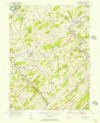
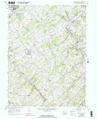
1953 Map of Seven Valleys
USGS Topo · Published 1956About this map
The Pennsylvania and Western Maryland railroads define the industrial character of south-central York County in the mid-1950s, converging at significant transit points like Hanover Junction. This landscape is deeply etched by the branching paths of Codorus Creek, which dictated the location of early settlements and milling sites. Small rural communities like Jefferson and Seven Valleys appear as vital hubs for the surrounding farm country, supported by a dense network of country schools and houses of worship.
Find a feature on this map
57 named features on this map. Tap any name to fly to it.
Don’t see what you’re looking for? This feature index may not catch every label — zoom into the map to look around manually.
Map Details
Editions of this 1953 Seven Valleys Map
5 editions found
Other maps of this area

1900 · Parkton
USGS Topo · 1:62,500

1902 · Parkton
USGS Topo · 1:62,500

1905 · Westminster
USGS Topo · 1:62,500

1908 · York
USGS Topo · 1:62,500

1910 · York
USGS Topo · 1:62,500

1920 · Hanover
USGS Topo · 1:62,500

1922 · Hanover
USGS Topo · 1:62,500

1944 · New Freedom
USGS Topo · 1:31,680

1944 · Manchester
USGS Topo · 1:31,680

1944 · Lineboro
USGS Topo · 1:31,680