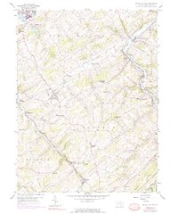
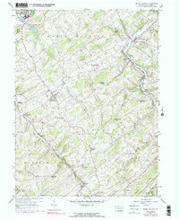
1953 Map of Seven Valleys
USGS Topo · Published 1975About this map
Seven Valleys and Jefferson serve as the primary hubs in this corner of York County, where the topography is defined by the winding paths of Codorus Creek and its branches. The landscape is characterized by a dense network of upland ridges like Dug Hill Ridge and Saubel Hill, punctuated by numerous small rural congregations and schools such as Zion Shaeffer Union Ch and the Snyder Sch. The importance of rail transit is evident through the path of the Penn Central line and Hanover Junction, which historically linked these agrarian valleys to broader industrial markets.
Find a feature on this map
52 named features on this map. Tap any name to fly to it.
Don’t see what you’re looking for? This feature index may not catch every label — zoom into the map to look around manually.
Map Details
Editions of this 1953 Seven Valleys Map
5 editions found
Other maps of this area

1900 · Parkton
USGS Topo · 1:62,500

1902 · Parkton
USGS Topo · 1:62,500

1905 · Westminster
USGS Topo · 1:62,500

1908 · York
USGS Topo · 1:62,500

1910 · York
USGS Topo · 1:62,500

1920 · Hanover
USGS Topo · 1:62,500

1922 · Hanover
USGS Topo · 1:62,500

1944 · New Freedom
USGS Topo · 1:31,680

1944 · Manchester
USGS Topo · 1:31,680

1944 · Lineboro
USGS Topo · 1:31,680