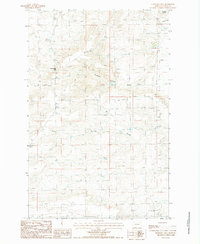
1987 Map of Sevenmile Hill
USGS Topo · Published 1987About this map
Sevenmile Hill rises above a landscape defined by significant irrigation infrastructure and the natural hydrological features of Teton County. Water management is central to this area in the late 1980s, evidenced by the presence of the Cascade Canal and the natural water source at Silverman Springs. The terrain transitions from the distinct elevation of Priest Butte in the northeast to the low-lying Alkali Flat. Local industrial activity is represented by a Gravel Pit, while the sinuous path of Roundup Coulee provides a natural drainage route through the undulating topography. This survey captures a moment when the regional economy remained tied to the land, balancing resource extraction and the essential transport of water across the northern Montana plains.
Find a feature on this map
9 named features on this map. Tap any name to fly to it.
Don’t see what you’re looking for? This feature index may not catch every label — zoom into the map to look around manually.
Map Details
Editions of this 1987 Sevenmile Hill Map
This is the sole edition of this map. No revisions or reprints were ever made.
Other maps of this area

1920 · Choteau
USGS Topo · 1:125,000

1955 · Choteau
USGS Topo · 1:250,000

1957 · Choteau
USGS Topo · 1:250,000

1958 · Choteau
USGS Topo · 1:250,000

1960 · Bynum
USGS Topo · 1:62,500

1960 · Choteau
USGS Topo · 1:62,500

1960 · Gilman
USGS Topo · 1:62,500
1960 · Freezeout Lake
USGS Topo · 1:62,500

1962 · Choteau
USGS Topo · 1:250,000
1976 · Choteau
USGS Topo · 1:250,000