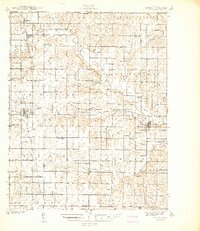
1941 Map of Severy
USGS Topo · Published 1941About this map
Severy serves as a central hub in this corner of southeastern Kansas, where the Atchison Topeka and Santa Fe and St Louis San Francisco railroads intersect. This 1930s-era survey reveals a landscape densely populated with small rural institutions, including an unusually high concentration of schoolhouses like North Pole Sch, Hideout Sch, and Prairie de Chene Sch. These named schools, often spaced just a few miles apart, indicate the robust agricultural community of the pre-war period.
Find a feature on this map
61 named features on this map. Tap any name to fly to it.
Don’t see what you’re looking for? This feature index may not catch every label — zoom into the map to look around manually.
Map Details
Editions of this 1941 Severy Map
3 editions found

Other maps of this area

1885 · Eureka
USGS Topo · 1:125,000

1885 · Sedan
USGS Topo · 1:125,000

1886 · Fredonia
USGS Topo · 1:125,000

1886 · Independence
USGS Topo · 1:125,000

1888 · Eureka
USGS Topo · 1:125,000

1889 · Sedan
USGS Topo · 1:125,000

1894 · Fredonia
USGS Topo · 1:125,000

1894 · Independence
USGS Topo · 1:125,000

1894 · Eureka
USGS Topo · 1:125,000

1905 · Independence
USGS Topo · 1:125,000