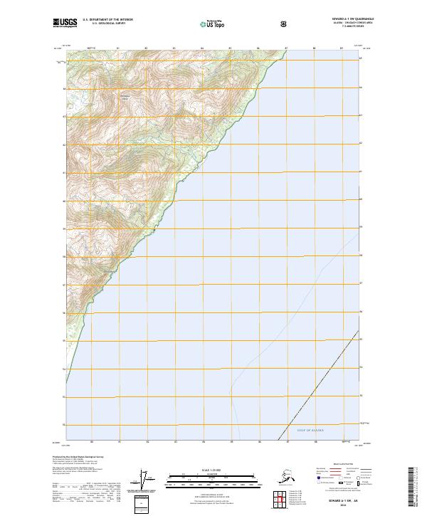
2024 Map of Seward A-1 SW
USGS Topo · Published 2024About this map
Montague Island dominates the topography of this maritime landscape, where steep coastal ridges descend sharply into the Gulf of Alaska. Much of the land is preserved as part of the Chugach National Forest, characterized by high-elevation contours that reveal the dramatic relief of the southwestern coastline. Along the western edge of the island, the Purple Bluffs stand as a prominent landmark for those navigating the waters near the entrance of the gulf. This modern survey illustrates the intersection of federal land management and the raw Pacific coast, showing a wilderness area defined by its lack of roads and its focus on natural geological formations.
Find a feature on this map
7 named features on this map. Tap any name to fly to it.
Don’t see what you’re looking for? This feature index may not catch every label — zoom into the map to look around manually.
Map Details
Editions of this 2024 Seward A-1 SW Map
This is the sole edition of this map. No revisions or reprints were ever made.
Other maps of this area

1946 · Blying Sound
USGS Topo · 1:250,000

1951 · Blying Sound
USGS Topo · 1:250,000

1951 · Seward
USGS Topo · 1:250,000

1951 · Seward A-2
USGS Topo · 1:63,360

1951 · Blying Sound D-1 and D-2
USGS Topo · 1:63,360

1951 · Seward A-1
USGS Topo · 1:63,360

1953 · Seward A-2
USGS Topo · 1:63,360

1953 · Seward A-1
USGS Topo · 1:63,360
1953 · Blying Sound D-1 and D-2
USGS Topo · 1:63,360

1953 · Blying Sound
USGS Topo · 1:250,000