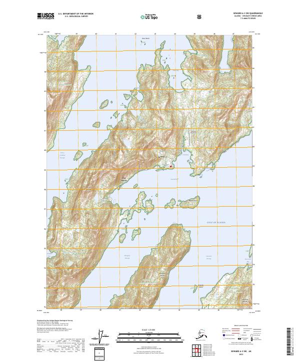
2023 Map of Seward A-3 SW
USGS Topo · Published 2023About this map
Chenega stands as a focal point on this coastal survey, situated along the sheltered waters of Crab Bay within the Chugach National Forest. The geography is defined by a dense archipelago, featuring the significant landmasses of Evans Island, Elrington Island, and Latouche Island, separated by deep glacial passages like Prince of Wales Passage and Latouche Passage. Local infrastructure is concentrated around the community, with the Chenega Bay Airport and the Airport Access Road providing essential links to the rugged interior. Further south, Port Ashton marks another point of human activity near the mouth of Sawmill Bay. The landscape is a complex network of maritime navigation and isolation, where settlements like Chenega rely on these waterways and small airfields for connectivity to the larger Prince William Sound region.
Find a feature on this map
31 named features on this map. Tap any name to fly to it.
Don’t see what you’re looking for? This feature index may not catch every label — zoom into the map to look around manually.
Map Details
Editions of this 2023 Seward A-3 SW Map
This is the sole edition of this map. No revisions or reprints were ever made.
Other maps of this area

1946 · Blying Sound
USGS Topo · 1:250,000

1950 · Blying Sound D-4
USGS Topo · 1:63,360

1951 · Blying Sound
USGS Topo · 1:250,000

1951 · Seward
USGS Topo · 1:250,000

1951 · Seward A-3
USGS Topo · 1:63,360

1951 · Seward A-4
USGS Topo · 1:63,360

1952 · Seward A-3
USGS Topo · 1:63,360

1952 · Seward A-4
USGS Topo · 1:63,360
1952 · Blying Sound D-4
USGS Topo · 1:63,360
1953 · Blying Sound D-3
USGS Topo · 1:63,360