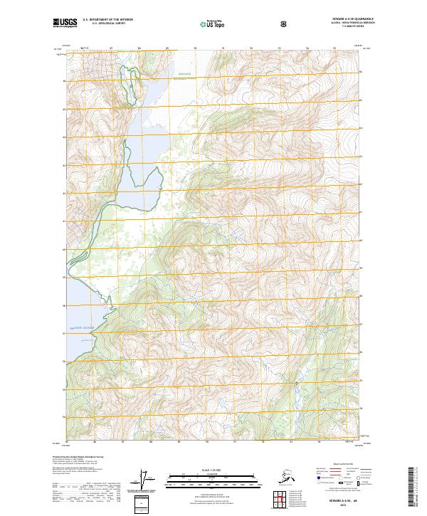
2023 Map of Seward A-6 SE
USGS Topo · Published 2023About this map
Chugach National Forest encompasses the high ridgelines and glaciated valleys of this coastal wilderness, where ice fields and steep contours dominate the interior landscape. The shoreline is defined by the Alaska Maritime National Wildlife Refuge, which protects the transition from land to the open Pacific Ocean. Deep within these coastal indentations, Resolute Cove provides a protected maritime pocket along the southern reaches of the Kenai Peninsula. The map detail reflects a largely undeveloped terrain of the early twenty-first century, organized by the Public Land Survey System coordinates of t1s r2e and t2s r3e, showing a land shaped by glacial retreat and dramatic elevation changes rather than human settlement.
Find a feature on this map
8 named features on this map. Tap any name to fly to it.
Don’t see what you’re looking for? This feature index may not catch every label — zoom into the map to look around manually.
Map Details
Editions of this 2023 Seward A-6 SE Map
This is the sole edition of this map. No revisions or reprints were ever made.
Other maps of this area

1946 · Blying Sound
USGS Topo · 1:250,000

1950 · Seward A-6
USGS Topo · 1:63,360

1950 · Blying Sound D-6
USGS Topo · 1:63,360

1950 · Blying Sound D-5
USGS Topo · 1:63,360

1951 · Blying Sound
USGS Topo · 1:250,000

1951 · Seward
USGS Topo · 1:250,000

1951 · Seward A-6
USGS Topo · 1:63,360

1951 · Seward A-5
USGS Topo · 1:63,360

1952 · Seward A-5
USGS Topo · 1:63,360
1952 · Blying Sound D-5
USGS Topo · 1:63,360