1952 Map of Blying Sound D-5
USGS Topo · Published 1954About this map
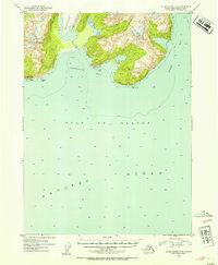
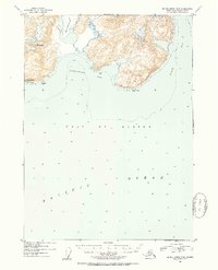
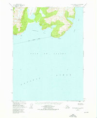
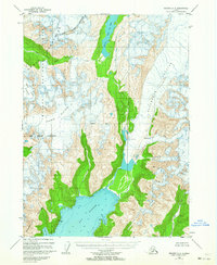
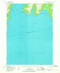
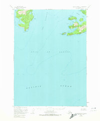
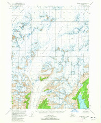
Excelsior Glacier descends from the high elevations of the Kenai Peninsula in this 1952 topographic study, its massive icy tongue reaching toward the coastal waters. The map details a dramatic coastline where the mountains meet the Gulf of Alaska, anchored by the prominent summit of Mt Fairfield. Coastal navigators and maritime historians will find specific interest in the deep indentations of Johnstone Bay and Puget Bay, separated by high ridges and rocky points. Significant landmarks like Cape Fairfield and Cape Junken define the shoreline, while offshore hazards such as Pinnacle Rock are noted for navigation. The survey, compiled from 1950 aerial photography, provides a precise record of the glacial extent and shoreline bathymetry before modern climatic shifts altered these remote ice fields and coastal features.
Find a feature on this map
10 named features on this map. Tap any name to fly to it.
Don’t see what you’re looking for? This feature index may not catch every label — zoom into the map to look around manually.
Map Details
Editions of this 1952 Blying Sound D-5 Map
4 editions found

Other maps of this area
1946 · Blying Sound
USGS Topo · 1:250,000
1950 · Seward A-6
USGS Topo · 1:63,360
1950 · Blying Sound D-6
USGS Topo · 1:63,360
1950 · Blying Sound D-4
USGS Topo · 1:63,360

1950 · Blying Sound D-5
USGS Topo · 1:63,360
1951 · Blying Sound
USGS Topo · 1:250,000

1951 · Seward
USGS Topo · 1:250,000

1951 · Seward A-6
USGS Topo · 1:63,360
1951 · Seward A-5
USGS Topo · 1:63,360
1951 · Seward A-4
USGS Topo · 1:63,360