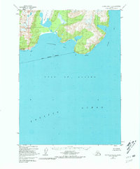
1952 Map of Blying Sound D-5
USGS Topo · Published 1981About this map
Excelsior Glacier dominates the northern reaches of this coastal landscape, its icy expanse reaching toward the sea between Mt Fairfield and the waters of Johnstone Bay. The 1952 topographic data, revised in 1973, reveals a shoreline shaped by glacial activity and the relentless energy of the Gulf of Alaska. Deep-water inlets like Puget Bay cut into the southern edge of the Kenai Peninsula Borough, bounded by distinctive maritime landmarks such as Cape Fairfield and Cape Junken.
Find a feature on this map
11 named features on this map. Tap any name to fly to it.
Don’t see what you’re looking for? This feature index may not catch every label — zoom into the map to look around manually.
Map Details
Editions of this 1952 Blying Sound D-5 Map
4 editions found
Other maps of this area

1946 · Blying Sound
USGS Topo · 1:250,000

1950 · Seward A-6
USGS Topo · 1:63,360

1950 · Blying Sound D-6
USGS Topo · 1:63,360

1950 · Blying Sound D-4
USGS Topo · 1:63,360

1950 · Blying Sound D-5
USGS Topo · 1:63,360

1951 · Blying Sound
USGS Topo · 1:250,000

1951 · Seward
USGS Topo · 1:250,000

1951 · Seward A-6
USGS Topo · 1:63,360

1951 · Seward A-5
USGS Topo · 1:63,360

1951 · Seward A-4
USGS Topo · 1:63,360