
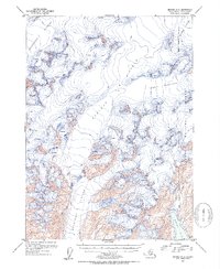
1952 Map of Seward A-5
USGS Topo · Published 1954About this map
Sargent Ice Field dominates this 1952 topographic study of the Kenai Peninsula, where massive glacial systems flow from high elevations toward the Gulf of Alaska. The map illustrates a landscape shaped by ice, identifying several named rivers of frozen water including Ellsworth Glacier, Tiger Glacier, and the Excelsior Glacier which feeds south into the coastal valley. Detailed contour work and numerous marked crevasses delineate the complex topography of the ice fields and the rock peaks that rise above them, most notably Pinnacle Mountain. To the southeast, the terrain meets the saltwater at Puget Bay, surrounded by the protected lands of the Chugach National Forest. This survey captures the mid-century extent of these glaciers, providing a baseline for geologists and researchers interested in the environmental history of the Chenega Glacier and its neighboring ice flows.
Find a feature on this map
11 named features on this map. Tap any name to fly to it.
Don’t see what you’re looking for? This feature index may not catch every label — zoom into the map to look around manually.
Map Details
Editions of this 1952 Seward A-5 Map
2 editions found
Other maps of this area

1946 · Blying Sound
USGS Topo · 1:250,000

1950 · Seward A-6
USGS Topo · 1:63,360

1950 · Blying Sound D-6
USGS Topo · 1:63,360

1950 · Blying Sound D-4
USGS Topo · 1:63,360

1950 · Blying Sound D-5
USGS Topo · 1:63,360

1951 · Blying Sound
USGS Topo · 1:250,000

1951 · Seward
USGS Topo · 1:250,000

1951 · Seward A-6
USGS Topo · 1:63,360

1951 · Seward B-4
USGS Topo · 1:63,360

1951 · Seward A-5
USGS Topo · 1:63,360