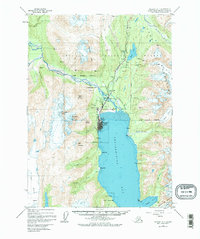
1950 Map of Seward A-7
USGS Topo · Published 1976About this map
Seward serves as the focal point of this coastal survey, positioned at the northern head of Resurrection Bay where the Alaska Railroad and Anchorage Seward Highway meet the sea. The map highlights the town's industrial and maritime infrastructure, including the Army Dock, City Dock, and the nearby Seward Airport. Educational and residential footprints are noted at Bayview School and the settlement of Woodrow to the north.
Find a feature on this map
44 named features on this map. Tap any name to fly to it.
Don’t see what you’re looking for? This feature index may not catch every label — zoom into the map to look around manually.
Map Details
Editions of this 1950 Seward A-7 Map
3 editions found
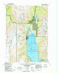
Other maps of this area

1946 · Blying Sound
USGS Topo · 1:250,000

1950 · Seward A-6
USGS Topo · 1:63,360

1950 · Seward A-8
USGS Topo · 1:63,360

1950 · Blying Sound D-7
USGS Topo · 1:63,360

1950 · Blying Sound D-6
USGS Topo · 1:63,360

1950 · Seward A-7
USGS Topo · 1:63,360

1951 · Blying Sound
USGS Topo · 1:250,000

1951 · Seward
USGS Topo · 1:250,000

1951 · Seward A-6
USGS Topo · 1:63,360

1951 · Seward A-7
USGS Topo · 1:63,360