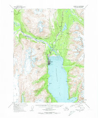
1951 Map of Seward A-7
USGS Topo · Published 1958About this map
Seward serves as the focal point of this coastal survey, positioned where the Alaska Railroad meets the deep waters of Resurrection Bay. At the time of this 1951 documentation, the town exhibits its identity as a vital logistics hub, featuring both an Army Dock and a City Dock alongside the Seward Airport. The presence of Bayview School and nearby settlements like Woodrow indicate a growing community established between the peaks of Marathon Mountain and the banks of the Resurrection River.
Find a feature on this map
39 named features on this map. Tap any name to fly to it.
Don’t see what you’re looking for? This feature index may not catch every label — zoom into the map to look around manually.
Map Details
Editions of this 1951 Seward A-7 Map
4 editions found
Other maps of this area

1946 · Blying Sound
USGS Topo · 1:250,000

1950 · Seward A-6
USGS Topo · 1:63,360

1950 · Seward A-8
USGS Topo · 1:63,360

1950 · Blying Sound D-7
USGS Topo · 1:63,360

1950 · Blying Sound D-6
USGS Topo · 1:63,360

1950 · Seward A-7
USGS Topo · 1:63,360

1951 · Blying Sound
USGS Topo · 1:250,000

1951 · Seward
USGS Topo · 1:250,000

1951 · Seward A-6
USGS Topo · 1:63,360

1951 · Seward A-7
USGS Topo · 1:63,360