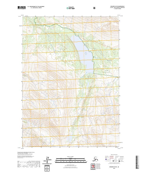
2023 Map of Seward B-8 SW
USGS Topo · Published 2023About this map
Upper Russian Lake serves as a central hydrological feature in this high-elevation Alaskan wilderness, where the Russian River begins its northward course. The landscape is defined by its protective status, split between the Kenai National Wildlife Refuge and the Chugach National Forest. The transition across these federal lands is particularly evident in the Kenai Wilderness (Andrew Simons Unit), which encompasses the western slopes above the lake. For those tracing historical transit through the Kenai Peninsula, the map documents the Russian Lakes Trl as it skirts the northern bank of the river and the eastern shore of the lake. The topography is exceptionally steep, with Summit Creek draining the eastern ridges, illustrating the difficult passage through this interior mountain corridor.
Find a feature on this map
12 named features on this map. Tap any name to fly to it.
Don’t see what you’re looking for? This feature index may not catch every label — zoom into the map to look around manually.
Map Details
Editions of this 2023 Seward B-8 SW Map
This is the sole edition of this map. No revisions or reprints were ever made.
Other maps of this area

1944 · Kenai
USGS Topo · 1:250,000

1950 · Kenai
USGS Topo · 1:250,000

1950 · Kenai B-1
USGS Topo · 1:63,360

1950 · Seward A-8
USGS Topo · 1:63,360

1951 · Seward
USGS Topo · 1:250,000

1951 · Kenai A-1
USGS Topo · 1:63,360

1951 · Seward B-8
USGS Topo · 1:63,360

1951 · Seward A-8
USGS Topo · 1:63,360
1952 · Seward A-8
USGS Topo · 1:63,360

1952 · Kenai A-1
USGS Topo · 1:63,360