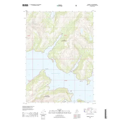
2018 Map of Seward C-4 SW
USGS Topo · Published 2018About this map
Prince William Sound dominates this coastal landscape within the Chugach National Forest, where the shoreline is deeply articulated by glacial inlets and narrow bays. The coastline is defined by dramatic geography, featuring the protective reach of Coxcomb Point and the sheltered waters of Shady Cove. To the west, Kings Bay provides a wide approach, while further east, the terrain is carved into distinct waterways including West Finger Inlet and East Finger Inlet. These deep marine penetrations into the forested land characterize the maritime environment of the Unorganized Borough. Further south, the map details the transition from open sound to more enclosed features like Greystone Bay and Deep Water Bay. This 2018 survey provides precise topographic detail of a region where the intersection of tide and timber defines the local geography, unmarred by roads or permanent settlements.
Find a feature on this map
15 named features on this map. Tap any name to fly to it.
Don’t see what you’re looking for? This feature index may not catch every label — zoom into the map to look around manually.
Map Details
Editions of this 2018 Seward C-4 SW Map
This is the sole edition of this map. No revisions or reprints were ever made.
Other maps of this area

1951 · Seward
USGS Topo · 1:250,000

1951 · Seward B-4
USGS Topo · 1:63,360

1951 · Seward C-5
USGS Topo · 1:63,360

1951 · Seward B-5
USGS Topo · 1:63,360

1951 · Seward C-4
USGS Topo · 1:63,360

1952 · Seward B-4
USGS Topo · 1:63,360

1952 · Seward C-5
USGS Topo · 1:63,360

1952 · Seward B-5
USGS Topo · 1:63,360

1952 · Seward C-4
USGS Topo · 1:63,360

1953 · Seward
USGS Topo · 1:250,000