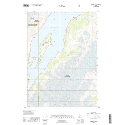
2018 Map of Seward C-5 NE
USGS Topo · Published 2018About this map
Blackstone Bay dominates this coastal landscape where the waters of Prince William Sound reach deep into the glaciated terrain of the Chugach National Forest. The geography is defined by an immense network of ice, including the Whittier Glacier, Ripley Glacier, and Tebenkof Glacier, which flow toward the shoreline. In the center of the bay, Willard Island sits as a prominent landmark amidst the surrounding peaks. The map also records the jurisdictional boundary between the Kenai Peninsula Borough and the Valdez-Cordova Census Area. This 2018 survey illustrates the complex glacial formations of the era, such as the Lawrence Glacier and Marquette Glacier, providing a technical look at the intersection of maritime and alpine environments.
Find a feature on this map
21 named features on this map. Tap any name to fly to it.
Don’t see what you’re looking for? This feature index may not catch every label — zoom into the map to look around manually.
Map Details
Editions of this 2018 Seward C-5 NE Map
This is the sole edition of this map. No revisions or reprints were ever made.
Other maps of this area

1951 · Seward
USGS Topo · 1:250,000

1951 · Seward D-5
USGS Topo · 1:63,360

1951 · Seward C-5
USGS Topo · 1:63,360

1951 · Seward D-4
USGS Topo · 1:63,360

1951 · Seward C-4
USGS Topo · 1:63,360

1952 · Seward D-5
USGS Topo · 1:63,360

1952 · Seward D-4
USGS Topo · 1:63,360

1952 · Seward C-5
USGS Topo · 1:63,360

1952 · Seward C-4
USGS Topo · 1:63,360

1953 · Seward
USGS Topo · 1:250,000