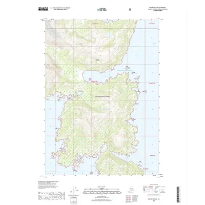
2018 Map of Seward D-2 NW
USGS Topo · Published 2018About this map
Chugach National Forest encompasses the entirety of this coastal wilderness, where the steep terrain of the Chugach Mountains meets the intricate shoreline of Prince William Sound. The landscape is dominated by glacial-carved topography and narrow maritime corridors, including the deep waters of Unakwik Inlet and the sheltered Siwash Bay. In the southern reaches, the coast becomes increasingly jagged, forming smaller inlets such as Mueller Cove, Schoppe Bay, and Eaglek Bay. The 2018 survey reveals a territory with no established roads or settlements, where navigation is dictated by the natural harbors and the rocky presence of Siwas Island. This map documents a high-latitude ecosystem where the transition from alpine peaks to sea level occurs over remarkably short distances, providing a detailed record of the pristine coastal interface in the early 21st century.
Find a feature on this map
17 named features on this map. Tap any name to fly to it.
Don’t see what you’re looking for? This feature index may not catch every label — zoom into the map to look around manually.
Map Details
Editions of this 2018 Seward D-2 NW Map
This is the sole edition of this map. No revisions or reprints were ever made.
Other maps of this area

1951 · Seward
USGS Topo · 1:250,000

1951 · Anchorage
USGS Topo · 1:250,000

1951 · Seward D-2
USGS Topo · 1:63,360

1951 · Seward D-3
USGS Topo · 1:63,360

1952 · Seward D-3
USGS Topo · 1:63,360

1952 · Seward D-2
USGS Topo · 1:63,360

1953 · Seward
USGS Topo · 1:250,000

1959 · Seward
USGS Topo · 1:250,000

1960 · Anchorage A-2
USGS Topo · 1:63,360

1960 · Anchorage A-3
USGS Topo · 1:63,360