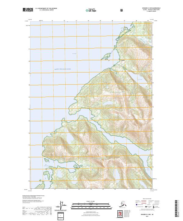
2023 Map of Seward D-3 NW
USGS Topo · Published 2023About this map
Golden sits along the northern edge of this coastal survey, where the waters of Port Wells meet the intricate coastline of Prince William Sound. The landscape is dominated by the steep, glaciated terrain of the Chugach National Forest, characterized by deep fjords and sharp elevation changes. To the east, the Avery River and Davis Lake are prominent hydrological features set against the backdrop of several high-elevation ridges. The southeastern corner is defined by the narrow waterway of Esther Passage, which separates the mainland from the surrounding island topography. This area, largely untouched by major road networks, retains its character as a maritime wilderness where settlement is sparse and dictated by the accessibility of the sound. The presence of Granite Bay and various coves suggests a geography defined by historical boat access and coastal navigation within the Chugach mountains.
Find a feature on this map
18 named features on this map. Tap any name to fly to it.
Don’t see what you’re looking for? This feature index may not catch every label — zoom into the map to look around manually.
Map Details
Editions of this 2023 Seward D-3 NW Map
This is the sole edition of this map. No revisions or reprints were ever made.
Other maps of this area

1951 · Seward
USGS Topo · 1:250,000

1951 · Anchorage
USGS Topo · 1:250,000

1951 · Seward D-4
USGS Topo · 1:63,360

1951 · Seward D-3
USGS Topo · 1:63,360

1952 · Seward D-3
USGS Topo · 1:63,360

1952 · Seward D-4
USGS Topo · 1:63,360

1953 · Seward
USGS Topo · 1:250,000

1959 · Seward
USGS Topo · 1:250,000

1960 · Anchorage A-4
USGS Topo · 1:63,360

1960 · Anchorage A-3
USGS Topo · 1:63,360