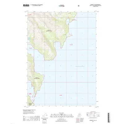
2017 Map of Seward D-4 NE
USGS Topo · Published 2017About this map
Chugach National Forest land dominates this coastal landscape where the waters of Prince William Sound meet the steep topography of the mainland. The shoreline is deeply indented by inlets such as Hobo Bay, Bettles Bay, and Hummer Bay, which are fed by glacial and mountain runoff from Hobo Cr and Lagoon Cr. A key historical feature is the Granite Mine Access Trail, which traces a path along the northern coast near Harrison Lagoon. This trail indicates the region's history of mineral extraction, providing access to remote interior locations from the waters of Port Wells. The map reflects a landscape where maritime access and terrestrial exploration have long intersected at the water's edge.
Find a feature on this map
16 named features on this map. Tap any name to fly to it.
Don’t see what you’re looking for? This feature index may not catch every label — zoom into the map to look around manually.
Map Details
Editions of this 2017 Seward D-4 NE Map
This is the sole edition of this map. No revisions or reprints were ever made.
Other maps of this area

1951 · Seward
USGS Topo · 1:250,000

1951 · Anchorage
USGS Topo · 1:250,000

1951 · Seward D-4
USGS Topo · 1:63,360

1951 · Seward D-3
USGS Topo · 1:63,360

1952 · Seward D-3
USGS Topo · 1:63,360

1952 · Seward D-4
USGS Topo · 1:63,360

1953 · Seward
USGS Topo · 1:250,000

1959 · Seward
USGS Topo · 1:250,000

1960 · Anchorage A-4
USGS Topo · 1:63,360

1960 · Anchorage A-3
USGS Topo · 1:63,360