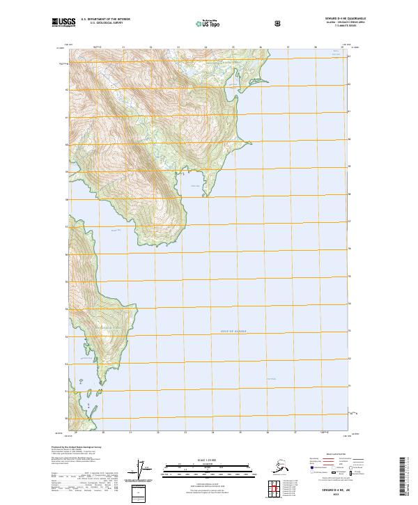
2023 Map of Seward D-4 NE
USGS Topo · Published 2023About this map
Chugach National Forest encompasses the entirety of this coastal landscape, where the steep terrain of the Kenai Peninsula meets the waters of Port Wells. The coastline is defined by a series of deep inlets including Hobo Bay, Bettles Bay, and Hummer Bay, illustrating the complex glacial geography of the region. Evidence of industrial history is found along the northern reaches, where the Granite Mine Access Trl provides a terrestrial link toward the interior, following the drainage of Hobo Creek. Further north, Harrison Lagoon and Lagoon Creek mark the transition from protected tidal waters to the high elevations of the surrounding mountains. This 2023 survey documents a wilderness area where human footprints are largely limited to access trails and maritime corridors within the Gulf of Alaska system.
Find a feature on this map
16 named features on this map. Tap any name to fly to it.
Don’t see what you’re looking for? This feature index may not catch every label — zoom into the map to look around manually.
Map Details
Editions of this 2023 Seward D-4 NE Map
This is the sole edition of this map. No revisions or reprints were ever made.
Other maps of this area

1951 · Seward
USGS Topo · 1:250,000

1951 · Anchorage
USGS Topo · 1:250,000

1951 · Seward D-4
USGS Topo · 1:63,360

1951 · Seward D-3
USGS Topo · 1:63,360

1952 · Seward D-3
USGS Topo · 1:63,360

1952 · Seward D-4
USGS Topo · 1:63,360

1953 · Seward
USGS Topo · 1:250,000

1959 · Seward
USGS Topo · 1:250,000

1960 · Anchorage A-4
USGS Topo · 1:63,360

1960 · Anchorage A-3
USGS Topo · 1:63,360