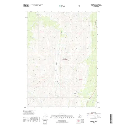
2018 Map of Seward D-7 SW
USGS Topo · Published 2018About this map
Sunrise sits along the northern edge of this high-elevation terrain within the Chugach National Forest, marking a point where early industrial and travel routes converged. This 2018 survey reveals a landscape defined by steep drainages and gold-rush era waterway names on the Kenai Peninsula. A network of unpaved access points including Palmer Creek Rd and the Palmer Lakes Trail penetrate deep into the interior, following the narrow valleys of Palmer Cr and Bonanza Cr. The map captures the meeting of modern infrastructure and wilderness, as the Hope Highway and Seward Highway skirt the edges of the high peaks. The numerous named creeks, such as Coeur d'Alene Cr and Canyon Cr, reflect the historic prospecting activity that shaped the region’s early development and nomenclature.
Find a feature on this map
28 named features on this map. Tap any name to fly to it.
Don’t see what you’re looking for? This feature index may not catch every label — zoom into the map to look around manually.
Map Details
Editions of this 2018 Seward D-7 SW Map
This is the sole edition of this map. No revisions or reprints were ever made.
Other maps of this area

1951 · Seward
USGS Topo · 1:250,000

1951 · Seward C-8
USGS Topo · 1:63,360

1951 · Seward D-8
USGS Topo · 1:63,360

1951 · Seward D-7
USGS Topo · 1:63,360

1951 · Seward C-7
USGS Topo · 1:63,360

1952 · Seward D-8
USGS Topo · 1:63,360

1952 · Seward C-8
USGS Topo · 1:63,360

1952 · Seward D-7
USGS Topo · 1:63,360

1953 · Seward C-7
USGS Topo · 1:63,360

1953 · Seward
USGS Topo · 1:250,000