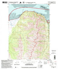
1995 Map of Seward D-8
USGS Topo · Published 1999About this map
The settlement of Hope anchors the northeastern corner of this 1995 revision, situated where Resurrection Creek meets the tidal flats of Turnagain Arm. The landscape is defined by the overlap of the Kenai National Wildlife Refuge and the Chugach National Forest, illustrating a complex network of conservation and resource management. The map details a legacy of extraction along Resurrection Creek, specifically identifying Historic Mining District Tailings, the Robinson-Bowman Mine, and the Pearson Mine.
Find a feature on this map
40 named features on this map. Tap any name to fly to it.
Don’t see what you’re looking for? This feature index may not catch every label — zoom into the map to look around manually.
Map Details
Editions of this 1995 Seward D-8 Map
This is the sole edition of this map. No revisions or reprints were ever made.
Other maps of this area

1944 · Kenai
USGS Topo · 1:250,000

1949 · Tyonek
USGS Topo · 1:250,000

1950 · Kenai
USGS Topo · 1:250,000

1951 · Seward
USGS Topo · 1:250,000

1951 · Anchorage
USGS Topo · 1:250,000

1951 · Tyonek
USGS Topo · 1:250,000

1951 · Kenai C-1
USGS Topo · 1:63,360

1951 · Kenai D-1
USGS Topo · 1:63,360

1951 · Seward C-8
USGS Topo · 1:63,360

1951 · Seward D-8
USGS Topo · 1:63,360