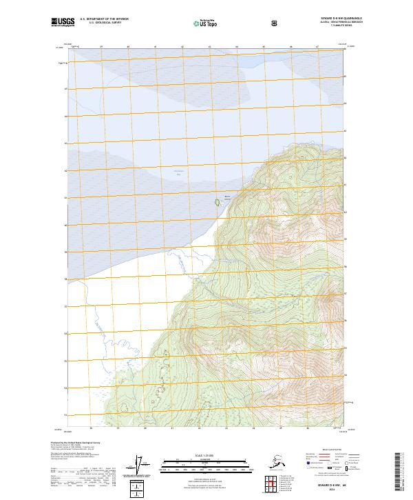
2024 Map of Seward D-8 NW
USGS Topo · Published 2024About this map
Chickaloon Bay and the coastal edges of the Kenai National Wildlife Refuge define this coastal landscape on the Kenai Peninsula. The map highlights the drainage patterns of the western Kenai mountains, where Big Indian Creek, Little Indian Creek, and Taylor Creek flow toward the mudflats and waters of the bay. The prominent landmark of Burnt Island sits just offshore, marking the transition from the steep, contoured slopes of the interior to the tidal flats. This 2024 survey captures the untouched character of the refuge, detailing the elevation changes and the specific course of Burnt Island Creek through the protected wilderness. It is an essential document for understanding the modern hydrology and topographical boundaries within this preserved Alaskan coastal ecosystem.
Find a feature on this map
12 named features on this map. Tap any name to fly to it.
Don’t see what you’re looking for? This feature index may not catch every label — zoom into the map to look around manually.
Map Details
Editions of this 2024 Seward D-8 NW Map
This is the sole edition of this map. No revisions or reprints were ever made.
Other maps of this area

1944 · Kenai
USGS Topo · 1:250,000

1949 · Tyonek
USGS Topo · 1:250,000

1950 · Kenai
USGS Topo · 1:250,000

1951 · Seward
USGS Topo · 1:250,000

1951 · Anchorage
USGS Topo · 1:250,000

1951 · Tyonek
USGS Topo · 1:250,000

1951 · Kenai D-1
USGS Topo · 1:63,360

1951 · Seward D-8
USGS Topo · 1:63,360

1951 · Tyonek A-1
USGS Topo · 1:63,360

1952 · Tyonek A-1
USGS Topo · 1:63,360