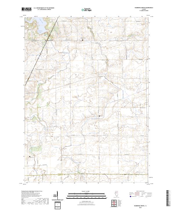
2024 Map of Shabbona Grove
USGS Topo · Published 2024About this map
Shabbona Grove sits at the heart of this agricultural landscape in southern DeKalb County, where the prairie has long been shaped by the drainage of Indian Creek and Little Indian Creek. The topography is marked by the presence of Shabbona Lake in the northwest, a significant water body providing a distinct break from the surrounding grid of farm-to-market roads. This survey documents the rural character of the area, noting the specific alignment of thoroughfares like Suydam Rd and Chicago Rd as they pass through the fertile Illinois plains.
Find a feature on this map
37 named features on this map. Tap any name to fly to it.
Don’t see what you’re looking for? This feature index may not catch every label — zoom into the map to look around manually.
Map Details
Editions of this 2024 Shabbona Grove Map
This is the sole edition of this map. No revisions or reprints were ever made.
Other maps of this area

1934 · De Kalb
USGS Topo · 1:62,500

1937 · De Kalb
USGS Topo · 1:62,500

1937 · Sycamore
USGS Topo · 1:62,500

1948 · Sandwich
USGS Topo · 1:62,500

1950 · Sandwich
USGS Topo · 1:62,500

1951 · Earlville
USGS Topo · 1:62,500

1958 · Aurora
USGS Topo · 1:250,000

1961 · Aurora
USGS Topo · 1:250,000
1968 · Hinckley
USGS Topo · 1:24,000
1971 · Leland
USGS Topo · 1:24,000